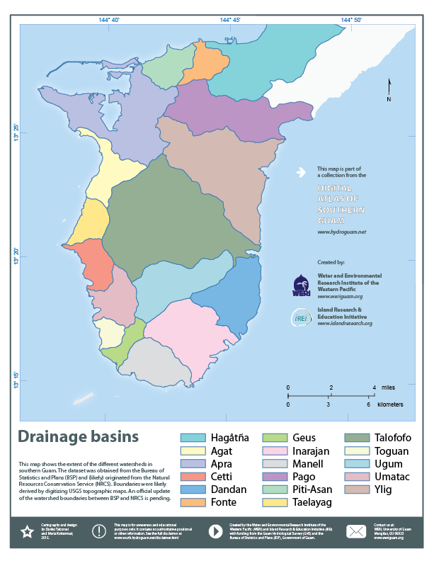
Southern Guam geospatial information serverDrainage basins
About this map:This map shows the extent of the different watersheds in southern Guam. The dataset was obtained from the Bureau of Statistics and Plans (BSP) and (likely) originated from the Natural Resources Conservation Service (NRCS). Boundaries were likely derived by digitizing USGS topographic maps. An official update of the watershed boundaries between BSP and NRCS is pending. |